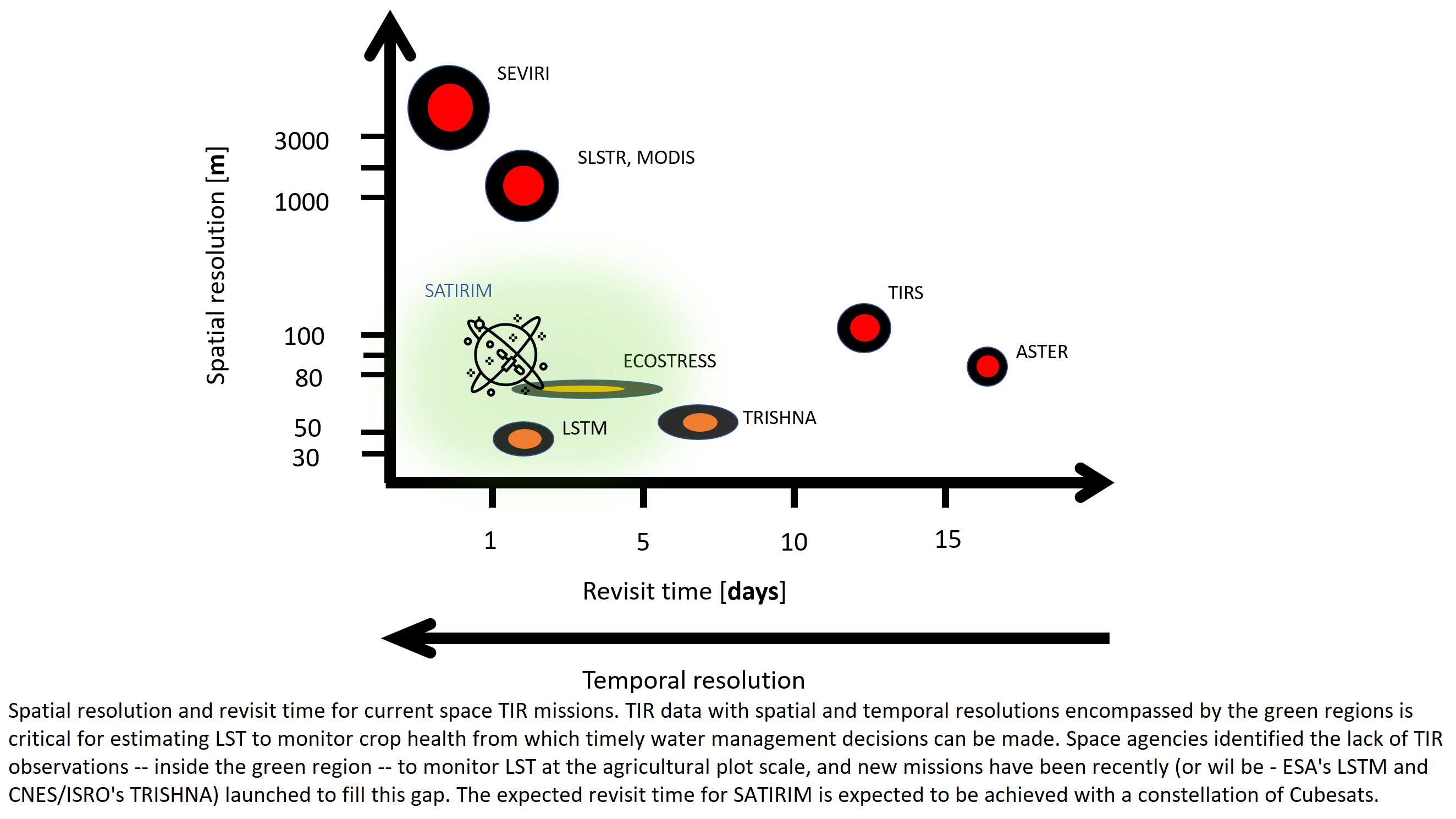
Determining land surface temperature (LST) from thermal infrared (TIR) remote sensing satellites at both high spatial and temporal resolution is considered extremely important for different applications, including agriculture. This interest is evidenced by the fact that the “High Spatio-Temporal Resolution Land Surface Temperature Monitoring (LSTM) Mission” has been identified as a Copernicus Expansion Mission. Furthermore, initiatives from the industry have started up to perform TIR imaging from small platforms, e.g. Hyperscout, ConstellR and SATIRIM. The latter project, initiated by VITO, aims to build up a constellation of TIR CubeSats with an IOD mission planned in 2024 and is supported by an ESA GSTP project. With the measurement of LST, evapotranspiration (ET) can be estimated that enables efficient water resources management, essential for sustainable agriculture. However, several issues demand additional research to fulfil LST and ET accuracy requirements. Without directional correction, temperature measurements of an observed scene obtained under different viewing directions can differ up to 15°C. The PhD research proposal aims to develop a directional anisotropy correction and an evapotranspiration determination methodology for high spatial resolution thermal infrared (TIR) satellite images, by adapting currently available algorithms. The practical objective of this research is the exploitability of the research results by TIR missions SATIRIM and LSTM. Based on these new TIR mission results, applications that require high spatiotemporal TIR data can be developed. One potential application is the optimization of irrigation systems to maximize crop yields without wasting water resources. Thus, the research can contribute to the retrieval of land surface temperatures, evapotranspiration and potential applications.

