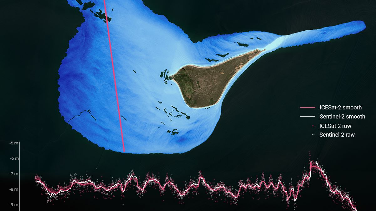
We are proposing to use data from the new ICESat-2 laser altimeter as basis for generating automated, consistent, and reliable calibration data for use in a highly automated production of satellite-derived bathymetry (SDB) based on Sentinel-2 data. Combining the data from ICESat-2/Sentinel-2 with advanced machine learning will allow for efficient novel mapping of the Worlds dynamic coastal zones. The proposed activity will build on top of DHI GRAS current state-of-the-art satellite-derived bathymetry methodology (as supported by Artes / H2020) where a state-of-the-art physical transfer routine is used to derive water depths. During the activity, several novel developments will be made: - Automated signal processing routines of ICESat-2 data for extraction of bathymetry from the laser photon clouds - Creation of a novel self-calibrating data-fusion and machine learning approach where ICESat-2 data is used as reference for Sentinel-2 bathymetry - Optimization of our existing Sentinel-2 SDB radiative transfer models for GPU processing in an elastically scaling cloud environment (e.g. DIAS) - Achieve high degree of automation through Bayesian optimization of model parameters based on the fusion of Sentine-2 and IceSat-2 data. DHI GRAS is a leading provider of SDB (our IP was e.g. the basis of the Bathymetrics ARTES IAP activity). This approach will expand our position as state-of-the-art SDB producer, through the combination of the currently used physical-based modelling approach with 1) auto-calibrating ML techniques, 2) independent calibration data points and 3) automation through Bayesian optimization. This leads to higher accuracy and much more efficient production. This integrated approach will be a big leap towards detailed assessment of the dynamics in the coastal zone, which is a core element of CMEMS future evolution and central for Blue Economy and marine spatial planning as well as maritime safety in general and in data sparse regions, such as e.g. the Arctic.