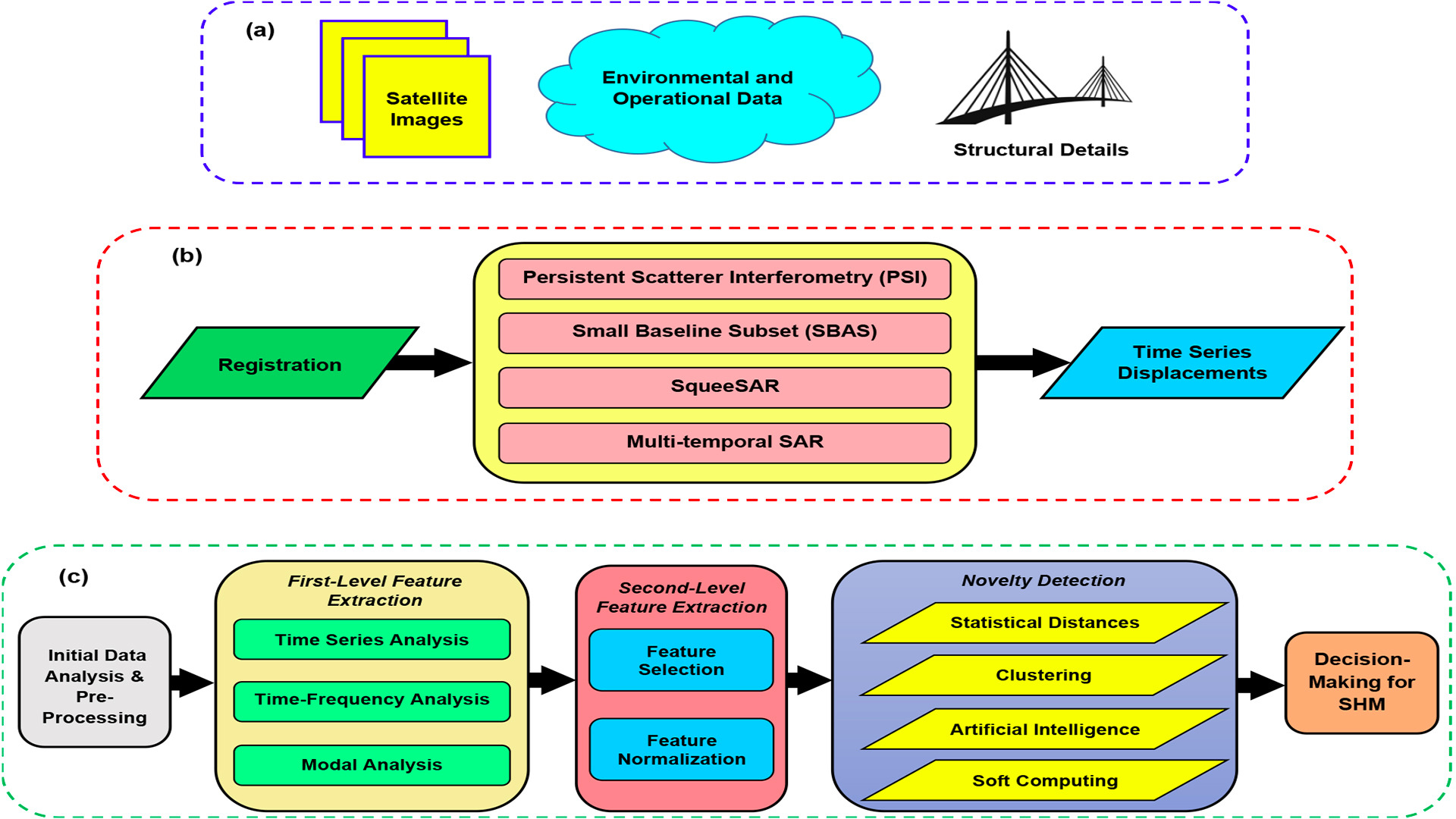
Structural health monitoring (SHM) is a great necessity for every society to prevent catastrophic events and tragic losses. Recently, the new technology of non-contact sensing offers the chance of monitoring of civil structures via images. Despite appropriate researches on SHM via non-contact sensors, it is may be difficult to monitor large civil structures such as dams and cross-sea bridges when one needs to observe large and wide areas. This issue may be more difficult for long-term SHM projects, which may be implemented at every hour. Moreover, such structures are not only subjected to various excitations but also some changes in their environments affect their structural behavior. To deal with these limitations, the use of satellite images and Synthetic Aperture Radar Interferometry provide an excellent opportunity for SHM. On the other hand, civil structures are always prone to environmental and operational variability, which are the major challenges in SHM due to false alarm and false detection. The other important challenge is the Big Data problem, particularly using high-resolution images. Despite the popularity of analyzing and interpreting time series displacements obtained from satellite images for SHM, the above-mentioned challenging issues make this process difficult, time-consuming, and erroneous. To address these challenges, this proposal proposes a novel method consisting of three main levels: (1) the preparation of satellite images, environmental data, and structural information, (2) the extraction of time series displacements from satellite images, and (3) the use of powerful data mining methods in terms of feature extraction and machine learning. The great novelty of the proposed method is on the third level, which is based on pre-processing of time series displacements, extracting reliable features, and utilizing novel machine learning algorithms. All these methods guarantee the results of SHM and alleviate concerns about the major challenges.

