Closed
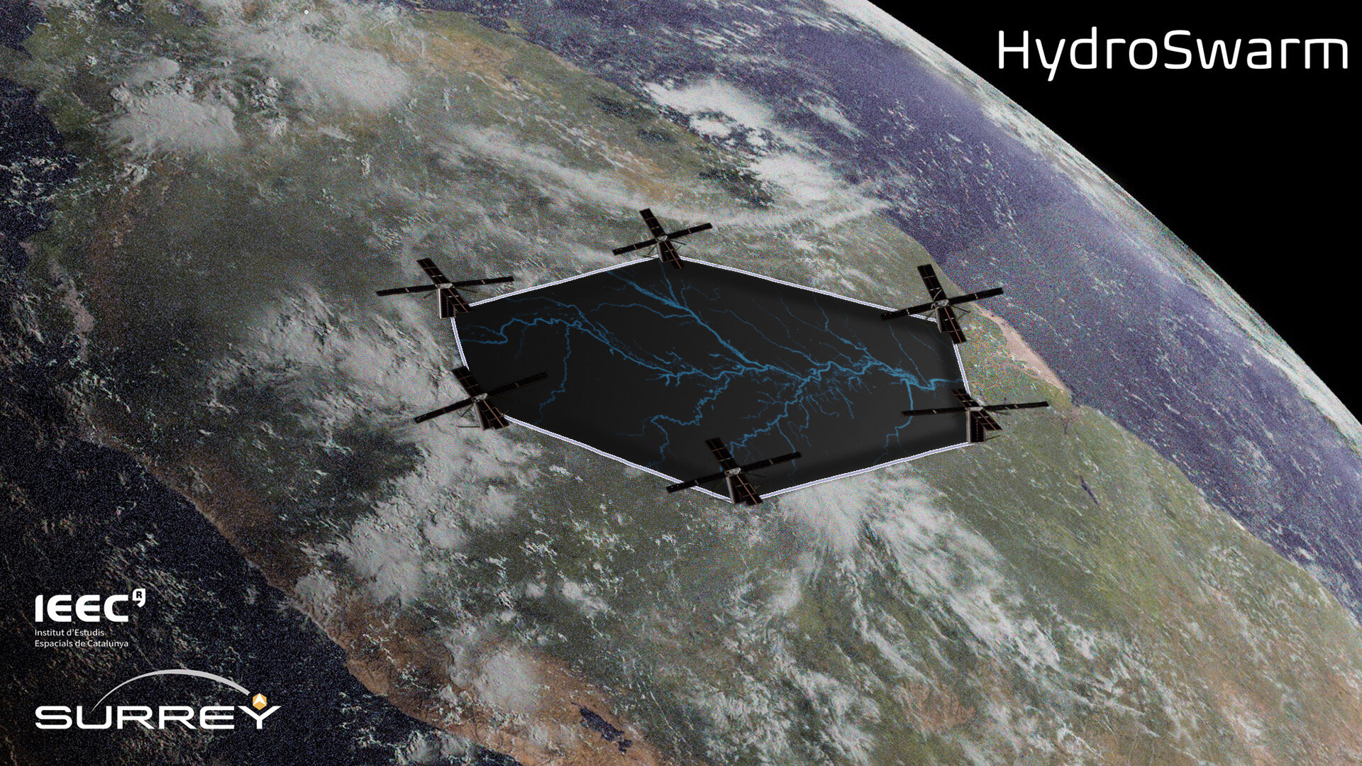
It is recognised that GNSS reflectometry, for example, on the ESA HydroGNSS mission, picks out coherent reflections from flat surfaces at higher resolution than incoherent reflections from elsewhere. When a surface is sufficiently flat, such as inland water or flooded areas, the coherent reflections offer a resolution of sometimes better than 1 km. The drawback is that as the resolution increases, the track footprint becomes thinner, and only a cross-section of information about the surface is produced from each track. If a 2D map is required, the picture must be built up by multiple passes from multiple satellites. If a swarm of satellites is deployed where each satellite is cross-track separated by > 1 km from each other, the measured GNSS reflection tracks can be systematically expanded into wider swath measurements, building up a 2D map of the flood faster, and allowing the angle of the flooded border and details of the edges to be determined whenever the threshold is crossed by the swarm. Reducing the separation of the swarm of the GNSS-R satellites further may allow signal processing and SAR techniques to resolve ambiguities and allow exploitation of more space within the Delay Doppler Map, enabling 2D imaging rather than just track-based measurements. GNSS-Reflectometry is uniquely suited to measuring flooding under clouds and under forest canopies because of the L-band and forward scatter nature of the measurements. Only a simple GNSS-R payload with a smaller antenna is required as coherent GNSS reflections are much stronger than incoherent reflections. To support this a swarm of 6 CubeSats would demonstrate two measurement techniques: coherent channel track mode where satellites are spaced apart by 1-5 km and cooperative SAR mode where spaced by 100m. This represents a novel mission benefiting from cutting edge GNSS remote sensing and advanced formation flying.