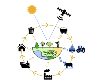
The importance of biodiversity and the severity of current losses are well-recognized. Land-use change for agricultural expansion is one of the main drivers of biodiversity declines. Agricultural expansion has largely served global commodity supply chains. Increasing awareness and commitment to address the environmental impacts of these commodity supply chains has been shown in recent years. Nonetheless, monitoring the impact of agricultural commodities on biodiversity through local land use both quantitatively and qualitatively remains challenging. Global spatially and temporally explicit data on biodiversity is generally lacking and/or sensitive, especially at relatively high resolutions. Moreover, the scale and proliferation of global supply chains present an opaque connection between its consumption and local biodiversity impacts. To address this, our analytical tools present state-of-the-art and spatially explicit quantification of biodiversity patterns at regional to continental scales using satellite earth observation. The advances of sensors, the continuous stream of high-quality observational data, and our computational capacity to analyze these data streams (AI & cloud computing) enable us to map ecologically relevant patterns of plant biodiversity – fundamental to terrestrial ecosystems. Furthermore, the synoptic and repeated observations of satellite remote sensing can link locally quantified plant biodiversity patterns to global supply chain impacts. Thereby, the impact of land use and commodity production on plant diversity can be understood through opportunity costs, the appraisal of (local) management practices, and near real-time monitoring of changes in plant biodiversity. Such information can help inform, guide, and reshape supply chain management regarding biodiversity losses caused by agricultural expansion and sourcing decisions, weighing in on the impact of agricultural commodities on plant biodiversity in (expanding) production landscapes.

