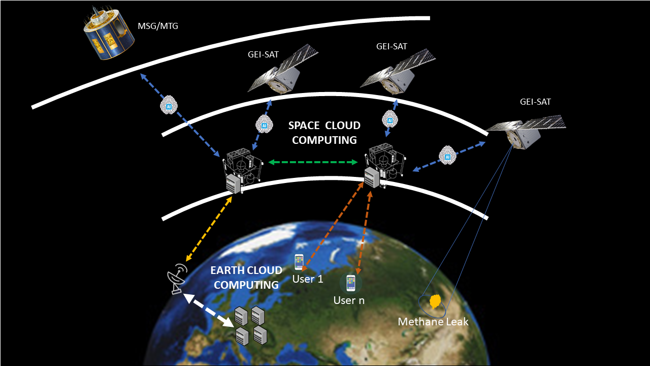
The Greenhouses gases emissions reduction is a priority for Governments & Environmental Agencies. Among the GHG, methane is the second most abundant after CO2, and it contributes to at least a quarter of today’s climate warming. The methane concentration continues to rise rapidly in large part from anthropogenic sources. Satellite observations are playing a key role to reduce uncertainty in methane emission monitoring by providing data across a range of spatial, temporal, and spectral resolutions or scales. In this scenario, SATLANTIS, in collaboration with PLANETEK, is proposing an innovative solution to perform Near Real-Time (NRT) CH4 measurements with a high spatial and temporal resolution to detect and quantify the methane source point leaks in gas facilities. The approach aims to combine top-down satellite imagery from multiple sources of information -such as VHR data through the upcoming SATLANTIS’GEI-SAT constellation and meteorological measurements from EUMETSAT MSG/MTG-, with the power of cutting-edge AI to generate NRT methane leaks detection and concentration products. The proposed approach will be analyzed and compared from three perspectives: 1) image processing on Earth, 2) image processing onboard of the satellite, and 3) image processing on a Cognitive Cloud Computing in Space (3CS) to reduce the latency of the products.