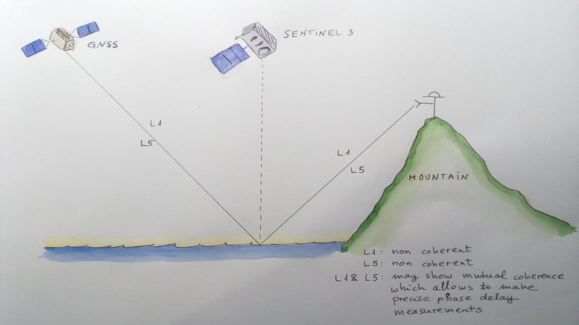
1) The GNSS Widelane Grazing Angle Carrier Phase Delay Altimetry (WL GA-CaPA) is an innovative idea aiming at precise sea surface height and sea ice thickness determination by combining GNSS reflected signals at two or more frequencies. This novel concept has never been tested before and could lead to a significant improvement in cubesat missions of the type of ESA’s PRETTY mission. This activity aims at performing a ground-based experiment to research the concept. 2) For this concept to work, the scattering must be coherent, thus limiting the actual coverage of a potential GA-CaPA mission. However there are very limited data sets which prevent to estimate the coverage area over the ocean where the concept might work. Hence, there is a need for an experimental verification of the concept over a broad range of ocean roughness conditions. 3) We suggest a field campaign from a mountain top overlooking the sea at GA geometry, near a Sentinel track, with a dedicated GNSS reflectometry equipment to grab signals at two carrier frequencies, and a deployed buoy to monitor the sea state. The objective is to characterize the range of sea conditions that enables WL GA-CaPA (L1/E1, L5/E5 and their frequency combination). 4) The concept can be embedded in GNSS radio occultation payloads, which are suitable for cubesat constellations. This would increase the spatio-temporal resolution of altimetric retrievals, complementing radar altimeters in a cost-effective way and permitting to tackle new science questions. The actual spatio-temporal coverage of WL GA-CaPA depends on its response to sea conditions, so the campaign will provide the information to conduct realistic studies on actual coverage of potential WL GA-CaPA missions. The outcome will be relevant to the ESA PRETTY mission, supporting calibration aspects and data processing ideas for follow-on missions.

