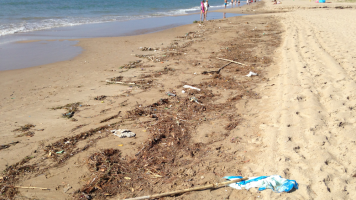
We are proposing the coupling of satellite derived hydrodynamic information, light reflectance and water quality with regional coastal models in order to develop a system focused to identify plastic hot-spots in coastal waters. The proposed system uses information from Sentinel-1 and Sentinel-3 to derive hydrodynamic information (S1 SAR and S3 altimeter) and Sentinel-2 (S2 MSI) to derive water quality data and the potential presence of plastic accumulation hot-spots. An algorithm will be derived based on analysis of different properties of plastic litter patches inferred from light reflectance (i.e. color, transparency, reflectivity and shape) and surface roughness (SAR signal). The EO based information is further feed into the modelling space through data assimilation and forcing of the model. This technique will be applied to the Catalan coast (Mediterranean Sea) as a proof-of-concept. The approach will be combined with reported plastic cleaning data to improve prediction capabilities. Cleaning data are available through the Catalan Waste Agency and City councils reporting location, number and sizes of collected plastic. The presence of observed plastic will be regressed with analysis of past satellite images. Information of winds, currents and water surface elevation derived from Sentinel-1 and -3 will be complemented with numerical modelling (COAWST) and the resultant hydrodynamic output analyzed with a Lagrangian solver (Parcels) to obtain trajectories of plastic litter. Plastic accumulation regions will be then identified and tracked in space and time and contrasted with cleaning data. The developed system will answer a high demand of a more efficient local to regional management of coastal plastic pollution by helping to identify hotspots of plastic accumulations in time and space. It will specifically serve regional and local authorities dealing with waste cleaning activities in the coastal domain, i.e. Barcelona harbor authority and the Catalan Waste Agency.

